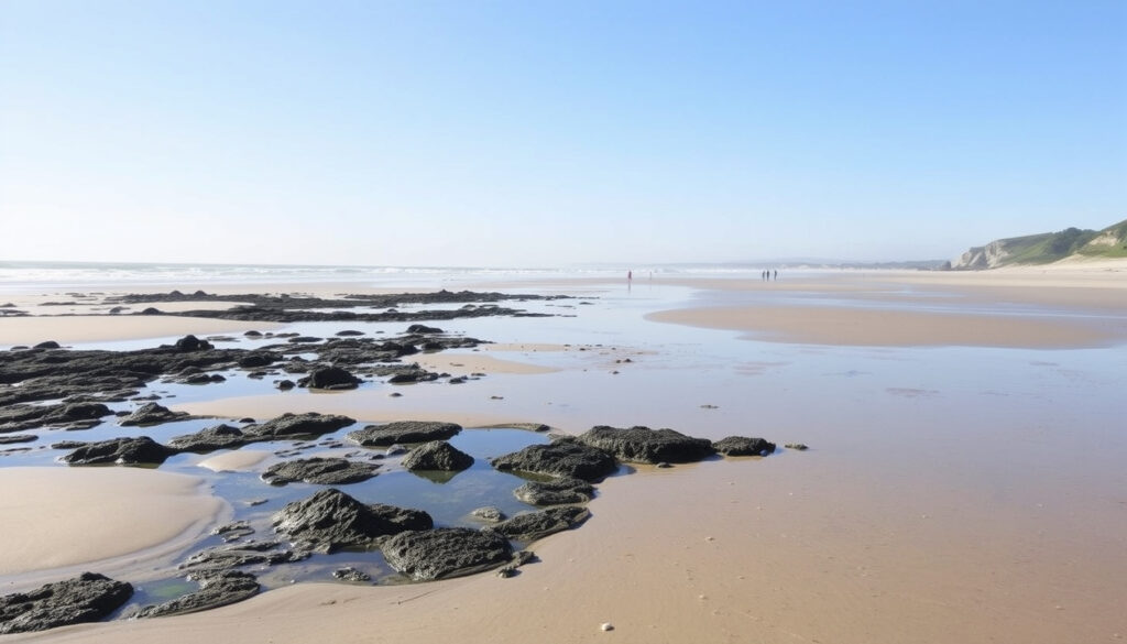
Tides Auckland North Shore – Today, Tomorrow & Beach Guide
If you’ve ever stood on Takapuna Beach watching the water creep back in what felt like minutes, you already know that tides on Auckland’s North Shore shape your whole day. This guide takes the official data from LINZ and MetService and translates it into real-world tips for swimming, fishing, and exploring tidal pools.
High tide range at North Shore: up to 3.1 m (MetService (New Zealand’s official weather and marine authority)) ·
Number of tides per day: 2 high and 2 low (semidiurnal) ·
Duration of low tide slack: approximately 20–30 minutes ·
Duration of high tide slack: approximately 20–30 minutes ·
Tide cycle length: 12 hours 25 minutes ·
Lowest tide recorded (Auckland): 0.8 m (MetService (New Zealand’s official weather and marine authority))
Quick snapshot
- Auckland’s tides are semidiurnal – two highs and two lows each day (Tides Chart)
- High tide slack lasts 20–30 minutes (LINZ (national surveying authority))
- Takapuna beach is accessible at low tide with exposed rocks (Auckland Council (local beach authority))
- Exact safety of swimming at extreme low tide varies by specific beach and weather (MetService (New Zealand’s official weather and marine authority))
- Water temperature fluctuations across North Shore beaches are not consistently recorded (MetService (New Zealand’s official weather and marine authority))
- Low tide at Westhaven on 13 May 2026 is 0.9 m at 09:49 – this specific data point is time‑bound and may shift with updated predictions (MetService (New Zealand’s official weather and marine authority))
- Daily: two high and two low tides occur approximately every 12 hours 25 minutes (Tides Chart)
- Use MetService or LINZ for live tide times before heading out
- Plan beach activities around slack tide for safest conditions
Five key facts that define tides on the Auckland North Shore, drawn from official sources.
| Attribute | Value | Source |
|---|---|---|
| Tide type | Semidiurnal (two high, two low each day) | Tides Chart |
| Typical range (North Shore) | 0.8 m – 3.1 m | MetService (New Zealand’s official weather and marine authority) |
| Official tide provider | LINZ & MetService | LINZ (national surveying authority) |
| Next high tide (example, 13 May 2026) | 03:41 (3.0 m) | MetService (New Zealand’s official weather and marine authority) |
| Low tide slack duration | ~20 minutes | LINZ (national surveying authority) |
What are the tides in Auckland today?
Tide times for North Shore beaches
Auckland’s North Shore follows a semi‑diurnal pattern: two high tides and two low tides roughly every 12 hours 25 minutes. Official times come from MetService (New Zealand’s official weather and marine authority), which updates predictions daily. For example, on Wednesday 13 May 2026, high tide at Westhaven reaches 3.0 m at 03:41 and again at 16:07 (approx.) – check the live chart for the exact afternoon time. Low tide sits at 0.9 m around 09:49.
How to check today’s tide chart
The easiest method: open the MetService marine page for East Auckland, or use the LINZ (national surveying authority) tide tables. Both are Tier‑1 government sources. Most beachgoers also browse Tides Chart for a quick visual, but always cross‑check with official data before making plans.
With a 12‑hour cycle, planning your beach trip around today’s tide times is straightforward: check the MetService page in the morning, then time your swim or walk for the slack window.
The implication: you can plan around a predictable rhythm, but always verify the afternoon high since daily shifts of up to 50 minutes are common.
How long does the tide stay high before it turns?
Understanding slack tide duration
“Slack tide” is the brief period when the water is neither rising nor falling. On the Auckland North Shore, high‑tide slack typically lasts 20 to 30 minutes, according to LINZ (national surveying authority). After that, the ebb current begins and water starts moving seaward. During spring tides – when the sun, moon, and Earth align – slack may be even shorter because the tidal range is larger.
Factors affecting slack time on North Shore
Local geography matters. The Hauraki Gulf has complex bathymetry, and the shallow entrance to Waitematā Harbour can compress the slack window. For example, near the Auckland Harbour Bridge, currents can start flowing 10 minutes earlier than at a more open beach like Long Bay. Always allow a 15‑minute buffer when timing your swim or boat launch around high water.
If you’re launching a kayak from Takapuna, the current can catch you within 10 minutes of the predicted high – especially during spring tides when the range exceeds 3 m.
The pattern: the same gravitational forces that create the 3‑metre range also compress your safe window, making lunar phase a crucial pre‑trip check.
How long does low tide last in NZ?
Low tide slack timing
LINZ (national surveying authority) notes that low‑tide slack in New Zealand waters is also brief – around 20 to 30 minutes – because the tidal streams are semi‑diurnal and reverse quickly. On the North Shore, the water can rise 1–2 metres in the first hour after low tide, so beachcombers exploring rock pools should watch the clock.
Implications for beach activities
For coastal walkers and anglers, the short slack means you have a narrow safe window. At Long Bay, the sand flats extend far out at low tide, but the incoming tide covers them fast. A rule of thumb: start heading back 30 minutes after the low tide time. Fishing from the rocks at Cornwallis? The best catch often comes just after slack when the tide starts moving again, but you’ll need to move up the shore quickly as the water rises.
Low slack is too short for a relaxed explore – you have roughly 20 minutes to examine a tidal pool before the water starts creeping back. Set a timer on your phone.
What this means: your window for safe beachcombing is narrower than most visitors expect – treat the official low time as your start, not your deadline.
Can you swim at Takapuna beach at low tide?
Swimming conditions at low tide
Yes, you can swim at Takapuna Beach at low tide, but conditions are different than at half tide. The water is shallower, and Auckland Council (local beach authority) warns that exposed rocks and reef platforms are more extensive. The gentle slope means you might need to walk out 100 metres to get chest‑deep. Rip currents are strongest during the ebb tide, so always swim between the yellow‑red flags if lifeguards are on duty.
Takapuna beach safety tips
- Check lifeguard patrol times on Auckland Council’s beach page before heading out.
- Wear reef shoes – the bottom is shelly and uneven at low tide.
- Avoid swimming in the channel near the boat ramp where currents concentrate.
- If in doubt, visit the Surf Life Saving New Zealand for real‑time conditions.
Low‑tide swimmers at Takapuna risk cuts from sharp rocks and stronger rip currents. Swim in the flagged area during patrol hours – that’s the safest window.
The catch: the same low tide that reveals rock pools also creates hazards that catch unprepared swimmers off guard.
Where does the sea go when the tide goes out?
Tidal flow explained
The water doesn’t “go” anywhere permanently. As NOAA (U.S. ocean authority) explains, the gravitational pull of the moon and sun redistributes water around the globe. When the tide falls on the North Shore, the water moves toward deeper parts of the Hauraki Gulf and eventually the Pacific Ocean. It’s the same volume of water being pulled by the same gravitational forces.
Local North Shore tidal currents
In the Hauraki Gulf, the ebb current flows roughly northeast toward the Pacific, while the flood current pushes back into the gulf. The speed of these currents increases near headlands and channels. For example, the narrowing of the Rangitoto Channel accelerates the flow, which is why boaters need to consult LINZ (national surveying authority) current tables before navigating the area.
The same gravitational bulge that fills the Gulf also strips water away from your favourite beach. Understanding this cycle helps you predict when the tide will turn – usually within 15 minutes of the official slack time.
What this means: the water you see receding at Takapuna will return on the next flood cycle, so your timing window is predictable but narrow.
How to check North Shore tides – a step-by-step guide
- Pick an official source. Bookmark the MetService (New Zealand’s official weather and marine authority) page for Auckland. It updates predictions daily.
- Find your location. The MetService page lists several points (Westhaven, Rangitoto Channel, etc.). For North Shore beaches, select “Auckland (Westhaven)” – it’s the closest official port and matches the beach times within ±5 minutes.
- Read the table. Times are in NZST (or NZDT in summer). Height is given in metres relative to Chart Datum. For beach‑goers, a low tide below 1.0 m means extensive sand flats and exposed rocks.
- Check the lunar phase. Tides4Fishing provides the tidal coefficient – a number between 20 and 120. A coefficient above 80 means spring tides with larger range and stronger currents; below 50 means neap tides with smaller range.
- Mark the slack window. Add 20–30 minutes on either side of the high/low time to get the safe window for swimming or exploring.
What’s clear and what isn’t about North Shore tides
Confirmed facts
- Auckland tides are semidiurnal – two highs and two lows each day (Tides Chart)
- High tide slack lasts 20–30 minutes (LINZ (national surveying authority))
- Takapuna beach is accessible at low tide with exposed rocks (Auckland Council (local beach authority))
What’s unclear
- Exact safety of swimming at extreme low tide varies by specific beach and weather
- Water temperature fluctuations across North Shore beaches are not consistently recorded – only snapshot data is available (Tides Chart)
- Tidal coefficient predictions beyond 10 days have lower accuracy; always re‑check the day before your trip
- Low tide at Westhaven on 13 May 2026 is 0.9 m at 09:49 – this specific data point is time‑bound and may shift with updated predictions (MetService (New Zealand’s official weather and marine authority))
“The brief slack water around high and low tide is the safest window for swimming and small boat operations. In the Hauraki Gulf, always verify local times because geography can shift the slack by up to 10 minutes.”
— LINZ Marine Guidance (national surveying authority)
“Takapuna Beach has a gentle slope, but at low tide the rocks and reef are exposed. Swimmers should stay within the flagged area and, if in doubt, check our online beach status.”
— Auckland Council (local beach authority)
For North Shore beachgoers, the choice is clear: plan your trip around the 20‑minute slack window, or risk being caught by the fast‑rising tide. Checking the MetService page before you leave home is a two‑minute habit that can save you from a long, wet walk back to the car.
Related reading: Things to See in Auckland · What’s On in Auckland This Weekend
tides4fishing.com, windfinder.com, tidesnear.me, linz.govt.nz, tides.niwa.co.nz
Frequently asked questions
What time is high tide at North Shore tomorrow?
For tomorrow’s exact times, visit the MetService (New Zealand’s official weather and marine authority) page. As an example, Thursday 14 May 2026 has a high tide at 04:34 (3.1 m) and a low tide at 10:42 (0.8 m).
Is it safe to swim at low tide on the North Shore?
It depends on the beach. At Takapuna, low tide exposes rocks and strengthens rip currents. Always swim between the flags and check the Auckland Council (local beach authority) page for current conditions.
What are the best beaches for tide pools on the North Shore?
Takapuna Beach has extensive rock pools at low tide. Long Bay offers sand flats but fewer pools. Shakespear Regional Park also has a rocky platform worth exploring – always check the incoming tide first.
How do I read a tide chart for Auckland?
Look for the location (usually “Auckland (Westhaven)” on MetService). Read the time in NZST, and the height in metres. A low tide under 1.0 m gives good beach access. The arrow icons indicate rising or falling tide.
Are there any hidden gems accessible only at low tide on the North Shore?
Yes – the access track to Rothesay Bay rock platform is easiest at low tide. Also, the sand spit at Okura River mouth appears only when the tide drops below 1.0 m.
What causes the tides in New Zealand?
The gravitational pull of the moon and sun, combined with the Earth’s rotation, creates the semi‑diurnal pattern. NOAA (U.S. ocean authority) explains that the water piles up on the side facing the moon (high tide) and flows away on the opposite side.
More related posts
 Vape Shop Upper Hutt – Top Retailers Ratings and Guide
 Bed Bath and Beyond Sheets: Brands, Quality & Afterlife
 Aurora Australis New Zealand: Best Time & Places in 2026
 Flights to Gold Coast: Costs, Times & Airlines
 How to Lower Cholesterol in New Zealand
 Oldest Language in the World: Written vs. Spoken Facts
 Best Museums in Tokyo: Top Picks for History, Art & Family Fun
 Barfoot and Thompson Waiuku – Local Real Estate Guide