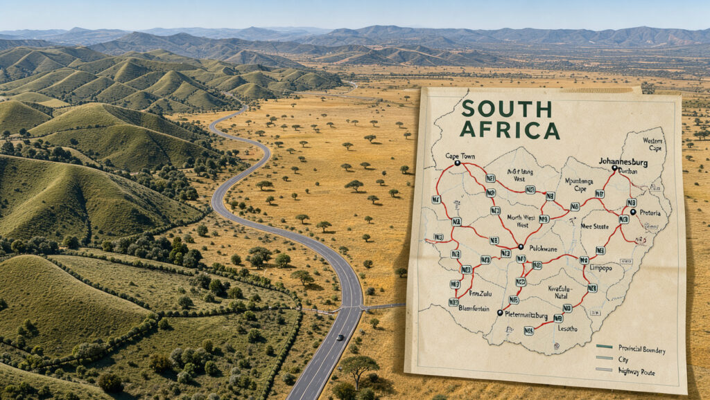
Map of South Africa: Provinces, Cities, Borders and Road Maps
Most readers open a map of South Africa to answer one question, where they are going and how long it will take, yet a tourist map and a road map of the same country can tell very different stories. This guide sticks to the facts that hold up, starting with the nine provinces that the South African Government portal (official) confirms, and shows where the three capitals, the neighbours and the main routes fit in.
Provinces: 9 · Capital cities: 3 (Pretoria, Cape Town, Bloemfontein) · Land area: 1,221,037 km² · Bordering countries: 6 (Namibia, Botswana, Zimbabwe, Mozambique, Eswatini, Lesotho)
Quick snapshot
- Each province has its own Legislature, Premier and Executive Council, according to the South African Government portal (official) (Nations Online Project (political map))
- Lesotho is entirely enclosed by South African territory (Nations Online Project (political map))
- Population totals differ, and Dublin Journal gives a 2023 estimate of 60.6 million (Dublin Journal (travel publication))
- Border totals rely on Tier 3 travel data, which gives 5,244 km (Car Driving Directions (travel reference))
- The nine provinces took effect on 27 April 1994 (Mapity (mapping app))
- The three-capital system dates to 1910, according to OnTheWorldMap (map reference), though no second source confirms that date (Mapity (mapping app))
- Free printable PDF maps of the provinces and capitals are available (MundoMapa (printable maps))
- Check border and road figures against newer official releases before you rely on them. (MundoMapa (printable maps))
Seven rows, one pattern: the numbers readers quote most often are the ones with the thinnest sourcing, so check the notes before you repeat a total.
| Item | Value |
|---|---|
| Provinces | 9 |
| Capital cities | Pretoria (administrative), Cape Town (legislative), Bloemfontein (judicial) |
| Largest province by area | Northern Cape, 372,889 sq. km |
| Total land area | 1,221,037 km² |
| Bordering countries | Namibia, Botswana, Zimbabwe, Mozambique, Eswatini, Lesotho (enclave) |
| Total border length | 5,244 km, according to Car Driving Directions |
| Nine provinces took effect | 27 April 1994 |
Which provinces does South Africa have?
What are the nine provinces of South Africa?
- Gauteng is the smallest province by size yet one of the most populous, and Johannesburg is its capital, according to GIS Geography (GIS Geography (mapping reference)).
- Northern Cape is the largest province, with an area of 372,889 sq. km (World Atlas (reference atlas)).
- Eastern Cape’s capital is Bhisho, and Port Elizabeth and East London are its two largest cities (Africa Travel Association (travel guide)).
- KwaZulu-Natal, Limpopo, Mpumalanga and North West have Pietermaritzburg, Polokwane, Mbombela and Mahikeng as capitals, according to the South African Government portal (official).
- Western Cape and Free State complete the nine, with Cape Town and Bloemfontein holding the legislative and judicial roles, according to the Nations Online Project (political map).
How are provinces shown on a provincial map?
- Provincial boundaries appear as separate shaded areas on most political maps.
- Some maps label each province with its capital, while others show only the province name.
- Check the legend first, because a missing capital label is a design choice, not an error.
The implication: a provincial map is a reliable way to learn the nine names, but the capital labels depend on the map’s purpose, so treat them as a starting point.
Where are the towns and cities on a map of South Africa?
Which major cities appear on a standard map?
- Pretoria is the administrative capital, Cape Town is the legislative capital and Bloemfontein is the judicial capital, according to the Nations Online Project (political map).
- Cape Town, Johannesburg, Bloemfontein, Port Elizabeth, Durban and the Garden Route sit on the national road network that SA-Venues maps (SA-Venues (road map guide)).
Why do city labels differ between map types?
- General maps favour provincial and national capitals, so smaller towns drop out first.
- Road maps keep towns that sit on through routes, even when they are small.
- Detailed maps add local towns, which makes them heavier to read at a glance.
A city label tells you the job a place does, not how large it is. A map that shows only one of Johannesburg or Cape Town is making a choice for you, so compare two map types before planning.
The implication: a missing town on a small map says more about the map’s purpose than about the town’s importance.
What do tourist and detailed maps of South Africa show?
What features do tourist maps include?
- Tourist maps are built around what is worth visiting, so attractions and parks tend to lead the design.
- They usually simplify the road layer so that a visitor can read the main routes quickly.
- Use them to choose a destination, then switch to a road map for the route itself.
When is a detailed map more useful than a general map?
- A detailed map helps when you need finer road networks or local boundaries.
- It is the better choice for a multi-stop route where a missing side road would cost time.
- A general map is enough for a first look at the country’s shape and neighbours.
Detail makes a map more useful for one trip and less useful for a quick overview. Pick the map that matches the question you are asking, not the one with the most lines.
The implication: the map type should follow the decision, whether that is where to go or how to get there.
How do road maps of South Africa help with travel?
Which national routes are labelled on road maps?
- The national road network connecting Cape Town, Johannesburg, Bloemfontein, Port Elizabeth, Durban and the Garden Route is mapped by SA-Venues (road map guide).
- According to Dublin Journal (travel publication), the straight-line distance from Cape Town to Johannesburg is roughly 1,400 km, and road maps of the N1, N2 and N3 are reportedly available from the Automobile Association.
How do you plan a route on a road map?
- Find both endpoints and note which province each one sits in.
- Trace the national route between them, and mark any toll sections on the legend.
- Measure the distance with the map scale, then compare it with the straight-line figure to see how much the road bends.
- Check the map’s publication date before you commit to a route.
Keep-left driving rules change how a junction reads on the map, so the New Zealand keep-left road rules guide is a useful companion when you check turn-offs.
How current are printed road maps?
- Road networks change, so a printed map can lag behind new construction.
- Route distances and numbering may shift as infrastructure projects finish.
A printed road map gives the route shape, not the live condition of the road. Treat a straight-line figure from a Tier 3 source as a rough guide, not a driving distance.
The implication: a road map is a planning tool for the route’s shape, and the final check belongs to a current source.
Which countries border South Africa?
Six neighbours, one pattern: the border lengths follow the same logic as the national total, so the largest border belongs to Botswana and the smallest to Zimbabwe, as Car Driving Directions lists them. For a wider view of how these countries sit in their regions, read countries of the world nations continents facts.
| Neighbour | Border length (km) |
|---|---|
| Botswana | 1,969 |
| Namibia | 1,005 |
| Lesotho | 1,106 |
| Mozambique | 496 |
| Eswatini | 438 |
| Zimbabwe | 230 |
How many countries border South Africa?
- Six countries share a border with South Africa: Namibia, Botswana, Zimbabwe, Mozambique, Eswatini and Lesotho, according to Car Driving Directions (travel reference).
Why is Lesotho shown as an enclave?
- Lesotho is a small landlocked nation forming an enclave entirely within South Africa, according to the Nations Online Project (political map).
- On a map, Lesotho appears as a shape surrounded by South African provinces, so it is easy to miss at small scales.
The implication: a border map that hides Lesotho gives a false picture of how the country is laid out, so look for the enclave on any map you use.
Confirmed facts and what’s unclear
Confirmed facts
- South Africa has nine provinces, according to the South African Government portal (official).
- Pretoria, Cape Town and Bloemfontein hold the administrative, legislative and judicial capital roles, according to the Nations Online Project (political map).
- Lesotho is enclosed by South African territory, according to the Nations Online Project (political map).
What’s unclear
- The population figure varies by source, with Dublin Journal citing 60.6 million (2023 estimate).
- The total border length of 5,244 km comes from Tier 3 travel data.
- Road distances and route numbering change with infrastructure projects.
- Coastline and largest-city claims differ across secondary sources and need an official check.
The implication: the confirmed column rests on official and reference sources, while the unclear column holds every figure that changes with the source, so check those before you quote them.
In the sources’ own words
Northern Cape is the largest province, with an area of 372,889 sq. km, while Gauteng is the most populous.
Paraphrased from the World Atlas (reference atlas)
Lesotho is a small landlocked nation forming an enclave entirely within South Africa.
Paraphrased from the Nations Online Project (political map)
The implication: both passages describe the country the way official and reference sources do, so readers can repeat them with the citation attached.
What this means for your map
The core facts are settled: nine provinces, three capitals, six neighbours and a land area of 1,221,037 km², according to the World Atlas (reference atlas). The softer figures, such as population and border totals, change with the source, so they belong in a note rather than a headline. For a driver planning a trip between Cape Town and Johannesburg, the choice is clear: use a current road map that shows the national routes, then confirm the route on a live navigation app. A driver who skips that check risks following a printed route that predates new construction.
nationsonline.org, mapsmaker.io, ontheworldmap.com, mapsofworld.com, ezilon.com, yearmaps.com
Frequently asked questions
Is Lesotho located inside South Africa on a map?
Yes. Lesotho is an enclave, which means it is entirely surrounded by South African territory, according to the Nations Online Project (political map).
What is the total land area of South Africa?
The total area is 1,221,037 km², according to the World Atlas (reference atlas).
Where can I find a printable map of South Africa?
MundoMapa (printable maps) offers free printable PDF maps of the nine provinces with their capitals.
When did the nine provinces take effect?
The nine provinces took effect on 27 April 1994, according to Mapity (mapping app).
Why do population totals differ?
Sources disagree. Dublin Journal (travel publication) cites a 2023 estimate of 60.6 million, while Car Driving Directions (travel reference) lists 57,398,421.
More related posts
 Mother’s Day 2025 NZ: Date, History & Employment Guide
 Sweet Child O’ Mine: Singer, Meaning and Release Facts
 How to Draw a Girl – Step-by-Step Beginner Guide
 Morgan Gibbs-White: Nationality, Parents, Transfer Fee, and Stats
 Symptoms of Kidney Stones: Early Warning Signs & Self-Care Tips
 Fish Stop Glen Eden: Menu, Hours, Gluten-Free Options
 What Animal Am I? Find Out via Quiz, Zodiac, or Birth Date
 homes.co.nz Guide: Login, App, Free Valuations & More in NZ