Queenstown to Christchurch Drive: Scenic Stops, Routes & Tips
There’s a reason the drive from Queenstown to Christchurch appears on so many travel bucket lists: it strings together some of New Zealand’s most breathtaking landscapes. But between the turquoise lakes and alpine passes, real questions come up — from winter chain requirements to whether Arthur’s Pass is as intimidating as it sounds. This guide combines official road data with local driving tips to help you plan the trip on your own terms.
Distance: 480–493 km (300–306 miles) ·
Non-stop drive time: 6 hours ·
Recommended duration: 3–5 days ·
Main route options: via Mount Cook (inland) or via West Coast (Arthur’s Pass) ·
Highest point: Arthur’s Pass (920 m / 3,018 ft) ·
Best time to drive: October–April (spring to autumn)
Quick snapshot
- Queenstown to Christchurch: 480–493 km (300–306 miles) depending on route (Air New Zealand fly-drive itinerary)
- Non-stop: 6 hours; best with 3–5 day itinerary (NZTA Journey Planner bulletins)
- October–April: mild weather, long daylight; May–September: snow possible, chains required (Air New Zealand fly-drive itinerary)
- Inland via Mount Cook (~480 km) or West Coast via Arthur’s Pass (~490 km) (Air New Zealand)
- Exact snowfall dates vary year to year; chain requirements depend on real-time weather (NZTA winter advisory)
- Road closure probabilities in winter depend on storm events, not a fixed schedule (NZTA winter advisory)
- Which route is “better” is subjective — inland is more scenic per official tourism but West Coast offers rainforest and coastal views (NZTA winter advisory)
- Summer (Dec–Feb): longest daylight, clear roads, heavy tourist traffic — book ahead (Air New Zealand seasonal notes)
- Autumn (Mar–Apr): mild weather, fewer crowds, golden foliage — ideal for photography (Air New Zealand seasonal notes)
- Winter (May–Sep): snow/ice on passes, chains mandatory when signs indicate, reduced daylight (GO Rentals chain guide)
- Spring (Oct–Nov): variable weather, lingering snow possible, wildflowers, fewer tourists (Air New Zealand seasonal notes)
- Check NZTA Journey Planner daily for real-time alerts on SH73 (Arthur’s Pass) and SH8
- Rent snow chains from Christchurch, Queenstown, or towns like Franz Josef before hitting alpine passes (NZTA Journey Planner)
- Plan for 3–5 days to enjoy major stops: Lake Tekapo, Mount Cook, and Wanaka (detour) (NZTA Journey Planner)
The table below summarizes key distance and altitude figures for planning.
| Detail | Value |
|---|---|
| Total distance | 480–493 km (300–306 miles) |
| Non-stop driving time | 6 hours |
| Highest point on inland route | Burkes Pass (712 m) / Lindis Pass (971 m) |
| Highest point on West Coast route | Arthur’s Pass (920 m) |
| Number of major passes | 2–3 depending on route |
| Recommended minimum days | 3 days |
Is the drive from Queenstown to Christchurch really scenic?
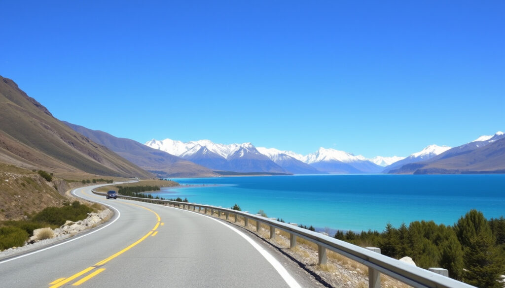
The short answer: yes — it ranks among the most beautiful road trips in New Zealand. The inland route via State Highway 8 passes the milky turquoise of Lake Tekapo, the Church of the Good Shepherd, and offers views of Aoraki Mount Cook from several pullouts. The West Coast route via Arthur’s Pass delivers rainforest, waterfalls, and dramatic mountain scenery. Air New Zealand’s fly-drive itinerary (a mainstream tourism reference) highlights Lake Dunstan and Lindis Pass as signature scenic points.
Key scenic highlights on the route
- Lake Tekapo — turquoise water and alpine setting; major photo stop (Air New Zealand – travel guide)
- Church of the Good Shepherd — historic stone chapel on the lake shore
- Mount Cook National Park viewpoints — visible from SH8 near Twizel
- Arthur’s Pass National Park — Otira Viaduct, Devils Punchbowl waterfall
- West Coast route — rainforest, coastal views near Hokitika
For pure scenery, the inland route wins on lake-and-mountain drama. But if you want diversity — forests, coastline, and a mountain pass experience — the West Coast route delivers. The choice depends on how much time you have: inland is shorter, West Coast needs an extra day.
Lake Tekapo and the Church of the Good Shepherd
Lake Tekapo’s vivid colour comes from glacial rock flour suspended in the water. It’s part of the Aoraki Mackenzie International Dark Sky Reserve, so stargazing is a bonus. The Church of the Good Shepherd, built in 1935, is one of New Zealand’s most photographed landmarks. Department of Conservation (DOC – national parks authority) maintains walking tracks in the area.
Mount Cook National Park viewpoints
From SH8 near Twizel, you get clear views of Aoraki Mount Cook on fine days. The road to Mount Cook Village is a 30‑minute detour from the main highway. According to DOC (New Zealand’s government conservation agency), the Hooker Valley Track is a popular short hike here.
Arthur’s Pass National Park
Arthur’s Pass on SH73 reaches 920 m. The road winds through beech forest, past the Otira Viaduct, and near several waterfalls like the Devils Punchbowl. DOC (national park management body) advises checking weather and track conditions before stopping for walks.
Where to stop on a road trip from Christchurch to Queenstown?
With 480–493 km to cover, multiple stops break the drive into manageable chunks. The most popular itinerary runs through Geraldine, Fairlie, Lake Tekapo, Twizel, Omarama, and Cromwell before reaching Queenstown. Air New Zealand’s fly-drive route confirms this corridor as the standard scenic touring path.
Recommended stopover towns
- Geraldine (from Christchurch, ~1.5 h): rural town, cheese shop, craft breweries.
- Fairlie (from Christchurch, ~2 h): known for the famous Fairlie Bakehouse pies.
- Lake Tekapo (from Christchurch, ~2.5 h): stargazing, hot pools, lake views.
- Twizel (from Christchurch, ~3.5 h): closest town to Mount Cook Village, salmon farms.
- Omarama (from Christchurch, ~4 h): Clay Cliffs, gliding centre, fuel stop.
- Wanaka (detour, add 30 min): Lake Wanaka, Puzzling World, That Wanaka Tree.
- Cromwell (from Christchurch, ~5 h): fruit orchards, wineries, historic town.
Each stop adds a genuine experience rather than a forced tourist trap. The local pies at Fairlie, the turquoise water at Tekapo, the Clay Cliffs near Omarama — these are the moments that turn a mere drive into a road trip you’ll remember. Plan at least 15 minutes per stop, longer for walks or meals.
Geraldine and the rural Canterbury Plains
Geraldine serves as the first good break from Christchurch. Its small town centre has bakeries, a cheese shop, and a craft brewery. The drive across the Canterbury Plains offers wide agricultural views with the Southern Alps in the distance.
Fairlie for a pie and a break
Fairlie Bakehouse is a institution — expect queues for their award-winning pies. It’s a quick leg‑stretch stop with clean bathrooms. The town marks the turnoff towards Lake Tekapo on SH8.
Lake Tekapo for stargazing and scenery
Lake Tekapo is the defining stop on the inland route. The Dark Sky Reserve status means After dark the stars are exceptional. The Church of the Good Shepherd and the Tekapo Springs hot pools are within walking distance. DOC (conservation management) notes the area is also a starting point for short hikes.
Twizel as a gateway to Mount Cook
Twizel is the last major town before Mount Cook Village. It has supermarkets, fuel stations, and accommodation. The drive from Twizel to Mount Cook Village (30 min) is stunning. Salmon farms along the way offer tastings.
Omarama and the Clay Cliffs
Omarama sits at about the halfway point (240 km from both Christchurch and Queenstown). The Clay Cliffs are a geological oddity — hoodoo formations accessible via a short gravel road. Omarama also has a gliding centre that uses thermals from the surrounding mountains.
Wanaka as a detour off the main route
Wanaka is a 30‑minute detour via the Crown Range road from the SH8 corridor. It offers Lake Wanaka, Puzzling World, and a vibrant café scene. If you have an extra day, this detour is worth it, but note the Crown Range is a steep alpine pass that requires caution in winter.
Cromwell for fruit and wine
Cromwell sits at the junction of SH8 and SH6. Its historic precinct has stone buildings, and the surrounding area is known for stone fruit (summer) and pinot noir. It’s a good final stop before Queenstown (30 min away).
The trade-off: Adding Wanaka and Cromwell means more driving but richer experiences. If you’re pressed for time, focus on Tekapo and Twizel as the essential stops — they give you 80% of the scenery with less detour.
What is halfway between Christchurch and Queenstown?
The approximate midpoint between Christchurch and Queenstown along the inland route is Omarama, roughly 240 km from each city. Air New Zealand’s route description confirms this positioning. Twizel, about 15 km south of Omarama, is a viable alternative with more accommodation options.
Exact halfway point location
On SH8, the precise halfway depends on your start and end points within each city. Using the city centres as reference, Omarama is the closest town to the geographic midpoint. On the West Coast route (SH73 then SH6), the midpoint shifts towards Hokitika or Greymouth, but that route is longer so the halfway is less precisely defined.
Omarama as the approximate midpoint
Omarama has a petrol station, a four‑square grocery, a few motels, and a café. It’s also the turnoff for the Clay Cliffs and a popular spot for gliding. If you’re driving non‑stop, it’s about 2.5 hours from Christchurch and 2.5 hours from Queenstown — a natural lunch stop.
- Twizel is 15 km south of Omarama — essentially the same distance.
- It has more accommodation, including hotels and holiday parks.
- For overnight stays, Twizel is the better choice.
- Both towns have fuel and basic amenities.
Why this matters: Knowing the halfway point helps you plan fuel and food stops. In winter, it also tells you where to check chain requirements — both Omarama and Twizel are below the alpine passes, so you’ll know if you need chains before you start climbing.
Is Arthur’s Pass scary to drive?
Arthur’s Pass (920 m elevation) is a narrow, winding mountain road with steep gradients. But “scary” is subjective. NZTA (New Zealand Transport Agency – government road authority) manages the pass with real‑time bulletins, and many drivers find it manageable with caution. It’s not the steepest pass in New Zealand — the Crown Range is steeper, and the Milford Road (SH94) has more challenging conditions according to Vroom Vroom Vroom (car rental comparison site).
Road conditions and difficulty
- Narrow lanes, no guardrails on some sections.
- Steep gradients: 1 in 10 in places.
- Weather changes rapidly: rain, snow, fog can occur within minutes.
- In winter, ice and snow are common; NZTA may impose chain restrictions (NZTA chain alerts)
Altitude and weather considerations
At 920 m, the pass is high enough to get snow even in late spring. In winter, up to 30 cm of snow can fall between 400 and 600 m according to NZTA weather bulletins. Fog reduces visibility, especially near the Otira Viaduct. If you’re driving a campervan or a large vehicle, the sharp corners require extra space.
Tips for driving Arthur’s Pass safely
- Check NZTA Journey Planner before departure and during the trip.
- Carry snow chains from May to October — they are legally required when signs are posted (GO Rentals (car rental operator) chain guide)
- Use low gear on descents to avoid brake fade.
- Pull over at designated viewpoints to let faster vehicles pass.
- Allow extra driving time — the pass is only 20 km long but can take 30‑45 minutes in good conditions, longer in snow.
Comparison with other New Zealand mountain passes
The following table compares the difficulty of New Zealand’s mountain passes.
| Pass | Max elevation | Steepness | Winter difficulty |
|---|---|---|---|
| Arthur’s Pass (SH73) | 920 m | Moderate (1:10) | Chains often required; snow common |
| Crown Range (Wanaka–Queenstown) | 1,076 m | Steeper (1:8) | Chains mandatory in snow; very narrow |
| Lindis Pass (SH8) | 971 m | Moderate | Snow and ice; chains required when posted |
| Milford Road (SH94) | 927 m | Steep sections | Chains mandatory in winter; avalanche risk |
Three winter passes, one common requirement: chains. Arthur’s Pass is not the toughest, but its rapid weather shifts make preparation essential.
Do I need snow chains to drive from Christchurch to Queenstown?
If you’re driving between May and October, the answer is almost certainly yes — carry chains, even if you don’t use them. NZTA (government road authority) can impose chain restrictions on SH73 (Arthur’s Pass), SH8 (Lindis Pass), and the Crown Range when snow falls. GO Rentals (New Zealand car rental company) lists Arthur’s Pass, Lewis Pass, Porters Pass, and Lindis Pass as alpine roads where chains should be carried in winter.
Legal requirements for snow chains
- Chain-fitting signs on the road mean chains are mandatory; ignoring them can result in a fine of up to $750 (GO Rentals fine warning)
- Most rental companies include chains as an extra — request them when booking.
- If you rent from Christchurch or Queenstown, check if chains are included; if not, buy or rent chains from outdoor stores or rental depots.
When snow chains are mandatory
NZTA posts electronic signs on approach to high‑risk passes. When conditions require chains, “Chains Essential” or “Chains Required” messages appear on variable message signs. NZTA bulletins also warn of potential road closures and advise carrying warm clothes, water, and food. If you rent from Christchurch or Queenstown, check if chains are included; if not, buy or rent chains from outdoor stores or rental depots.
Where to rent or buy snow chains
- Christchurch airport and Queenstown rental depots offer chains.
- Towns like Franz Josef, Hokitika (West Coast) also have rental outlets.
- Major outdoor equipment stores (e.g., Kathmandu, Macpac) sell chains.
- You can also pre‑book chains through rental companies like GO Rentals or Rental Cars 247 (winter driving specialist).
Tips for driving in snowy conditions
- Fit chains only on the driving wheels (front or rear depending on vehicle) – Rental Cars 247.
- Drive at max 20 km/h with chains — faster damages road and chains (Rental Cars 247)
- Follow the “4 second rule” for safe following distance in New Zealand – especially on wet or icy roads.
- According to NZ Travel Tips (travel advisory blog), snow is generally cleared quickly by graders, so even if you carry chains you may not need to fit them — but better safe than stopped.
The biggest risk is not the snow itself but being caught without chains when a winter storm passes through. A $75 chain rental is cheap insurance against a $750 fine and a ruined day. Check NZTA Journey Planner every morning before alpine legs, as Dream Drives (road trip guide) recommends.
Step‑by‑step: How to plan your Queenstown to Christchurch road trip
These steps combine official data and tested advice from the NZTA, rental companies, and seasoned travellers. Follow them in order to avoid common winter road‑trip headaches.
- Choose your route. Decide between inland (SH8, via Mount Cook) or West Coast (SH73/SH6, via Arthur’s Pass). Inland is faster and more scenic for lakes; West Coast offers more diverse landscapes. Air New Zealand’s fly-drive uses the inland route as its default.
- Set your itinerary length. Minimum 3 days for a relaxed trip; 5 days if you want detours (Wanaka, West Coast). One‑day non‑stop is possible but not recommended — you’d miss everything.
- Book a rental car with snow chains (if travelling May–October). Request chains when booking. GO Rentals and Rental Cars 247 include chain options.
- Check the weather and road conditions every morning using NZTA Journey Planner. Look for chain alerts, closures, and delays.
- Pack for emergencies. Carry warm clothes, water, snacks, a torch, and a phone charger. NZTA warns that conditions can change rapidly (NZTA alpine safety advisory)
- Plan your stops. At minimum: Fairlie (pie), Lake Tekapo (photo), Twizel (lunch), Cromwell (fruit). For longer trips, add a night in Tekapo or Omarama.
- Drive defensively. Follow the 4‑second rule on wet or icy roads. Let faster vehicles pass at pullouts. Use low gears on descents.
- Enjoy the journey. The final descent into Queenstown past the Remarkables is just as spectacular as the start.
The pattern: Following these steps ensures you’re prepared for any conditions, making the drive both safe and enjoyable.
What drivers say: First‑hand accounts and official guidance
“We checked NZTA before leaving Christchurch and saw ‘Chains Essential’ for Arthur’s Pass. Rented chains in town, fitted them at the Otira side, and drove through snow with no issues. The pass was stunning — not scary if you’re prepared.”
— Reddit user r/newzealand_travel, winter 2024 (community travel forum)
“Snow chains are a legal requirement when signs say so. We have a team updating our traffic bulletins in real time — always check before you go through alpine passes.”
— NZ Transport Agency (government road authority) advice via NZTA Journey Planner portal
The same Alpine scenery that draws visitors also creates the most challenging conditions. The snow‑capped peaks you’re photographing are the reason chains are needed. Embrace the contradiction — preparation lets you enjoy both safely.
The implication: Real driver experiences confirm that preparation is key to enjoying the route safely.
Clarity: Confirmed facts and what’s open
Confirmed facts
- Distance is 480–493 km depending on route (Air New Zealand)
- Non‑stop drive takes approximately 6 hours (NZTA)
- Arthur’s Pass is a mountain pass with steep gradients (NZTA road classification)
- Snow chains are legally required when signs are posted (GO Rentals)
- Lake Tekapo is a highlight on the inland route (Air New Zealand)
What’s unclear
- Exact snowfall dates vary year to year (meteorological uncertainty)
- Road closure probabilities in winter depend on weather events, not a fixed schedule
- Which route is “better” is subjective and depends on preferences
The pattern: While some details remain variable, the core facts are well-established for planning.
Summary: Your Queenstown to Christchurch road trip, planned right
This drive is one of New Zealand’s best, but its appeal comes with real safety demands. The inland route gives you postcard lakes and Mount Cook views; the West Coast route delivers variety and a mountain‑pass challenge. In winter, chains are not optional — they’re the difference between a smooth trip and a roadside wait. For the traveller who checks NZTA, carries chains, and picks stops that match their pace, the Queenstown to Christchurch drive is a highlight, not a hazard. For the unprepared, it’s a gamble you don’t need to take.
newzealand.com, facebook.com, destinationlesstravel.com, jimny.co.nz
Frequently asked questions
What is the best time of year to drive from Queenstown to Christchurch?
October–April (spring to autumn) offers mild weather, long daylight hours, and generally snow‑free passes. December–February brings peak tourist crowds and higher accommodation prices.
Should I take the inland route or the West Coast route?
Choose inland (SH8) if you want lake scenery and a faster drive. Choose West Coast (SH73/SH6) if you want rainforest, wild coastline, and Arthur’s Pass. Both are scenic — the West Coast needs an extra day.
How much does it cost for fuel on a Queenstown to Christchurch road trip?
At NZ$2.80–3.20 per litre, the 480–493 km trip costs roughly NZ$70–90 for a standard car. Prices vary; fill up in larger towns (Christchurch, Queenstown, Timaru) to save.
Are there electric vehicle charging stations along the route?
Yes. Chargers are available in Christchurch, Ashburton, Timaru, Fairlie, Lake Tekapo, Twizel, Omarama, Cromwell, and Queenstown. Check ChargeNet or the NZTA EV map for real‑time availability.
Can I do the drive in one day?
Yes, non‑stop is about 6 hours. But most travellers recommend at least 3 days to enjoy the scenery and avoid fatigue. One day is possible but you’ll miss the best parts.
What is the speed limit on New Zealand highways?
The default open‑road speed limit is 100 km/h. In winter or through alpine passes, reduce speed — especially on corners and steep gradients.
Do I need a 4WD for the Queenstown to Christchurch drive?
No. A standard 2WD car with snow chains is sufficient in winter. A 4WD may handle snow better but chains are still required when posted. For summer, any car works.
Where can I rent a car for a one‑way trip from Queenstown to Christchurch?
Major rental companies (Avis, Budget, Hertz, GO Rentals, Jucy) allow one‑way rentals between Queenstown and Christchurch. Book in advance, especially in summer. Some companies include snow chains as an extra.
The bottom line: This FAQ covers the most common concerns, but real-time conditions always require checking.
More related posts
 Black Snow Season 2 – Renewal, Premiere, Cast and Plot
 Pork Roast Cooking Times: Per Kg, Pound & Calculator
 Mild Pelvic Organ Prolapse: Symptoms, Stages, and Treatment
 Liquor Shop Near Me in Ireland: Off Licence Guide & Rules
 Samoa vs Tonga 2025 NZ Time – Kick-off Schedules for Kiwis
 Michael Hill Net Worth: Jewellery Empire, Yacht & Legacy
 Westlake Girls High School: Fees, Enrollment, and More
 Premier League Schedule 2024-25: Full Fixtures & Standings Guide