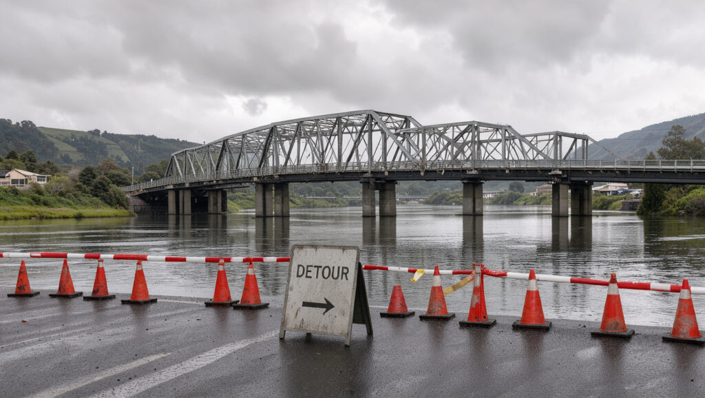
Kennedy Good Bridge Lower Hutt: Road and Trail Closures
If you have ever crawled across Lower Hutt on a weeknight, you know how fast one closure becomes a long detour. Kennedy Good Bridge now sits inside several overlapping works, from night-time State Highway 2 closures to a shut stretch of the Hutt River Trail, and Greater Wellington’s trail page (regional council that runs the trail) gives a western-side window starting in mid October 2025, so this piece separates dated notices from stale ones.
Closed walking and cycling section: Hutt River Trail, western side, with end points described differently across sources (Greater Wellington, regional council) · Flood closure of both bridges: Closed about 7–8pm, 20 April 2026 (The Post (Wellington newspaper)) · Programme figure in RNZ headline: $1.5b works (RNZ (public broadcaster)) · Full works completion: Some time in 2031 (RNZ, public broadcaster)
Quick snapshot
- Greater Wellington gives a trail closure window from mid October 2025 until at least May 2026 (Greater Wellington, regional council) (NZTA Journey Planner (state highway agency))
- Southbound SH2 was closed between Kennedy Good Bridge and Melling Link from 9pm to 4am, 7 to 9 April 2026 (NZTA Journey Planner (state highway agency))
- Kennedy Good and Melling Link bridges closed about 7–8pm on 20 April 2026 (The Post, Wellington newspaper) (NZTA Journey Planner (state highway agency))
- Where the western trail closure ends: Te Wai Takamori’s November 2025 update says Marsden Street towards Kennedy Good Bridge (Te Wai Takamori (flood and transport programme))
- Whether the trail closure still applies after May 2026, according to a tier 3 hiking blog (Hiking Dogs (independent hiking blog))
- Eastern-side trail status until river work is complete (Te Wai Takamori (flood and transport programme))
- Bridges reopened at around 3am on 21 April 2026 after engineer assessment (The Post, Wellington newspaper) (NZTA Journey Planner (state highway agency))
- Southbound SH2 night closure finished early on 9 September 2026 (NZTA Journey Planner (state highway agency))
- Full southbound closure, Melling Link to Dowse, scheduled for 22 September 2026 (Hutt City News (local news outlet))
- Queens Drive, between Rutherford and High streets, is closed until approximately 2029 (Te Wai Takamori (flood and transport programme))
- Full works are not expected to finish until some time in 2031 (RNZ, public broadcaster) (Te Wai Takamori (flood and transport programme))
- Block Road and the northern Riverbank car park are permanently closed (Te Wai Takamori, flood and transport programme) (Te Wai Takamori (flood and transport programme))
Ten dated rows, one pattern: the SH2 closures are short, fixed night windows, while the trail and Queens Drive closures run for months or years.
| Item | Detail |
|---|---|
| Closed trail section | Hutt River Trail, western side; end point disputed between sources (Greater Wellington, regional council) |
| Trail closure window | Mid October 2025 until at least May 2026 (Greater Wellington, regional council) |
| SH2 night closure, April | Southbound, 7–9 April 2026, 9pm–4am, for barrier installation (NZTA Journey Planner, state highway agency) |
| Flood closure of bridges | Closed about 7–8pm, 20 April 2026; reopened around 3am on 21 November 2025 (The Post, Wellington newspaper) |
| Queens Drive | Closed until approximately 2029 (Te Wai Takamori, flood and transport programme) |
| Block Road | Permanently closed (Te Wai Takamori, flood and transport programme) |
| SH2 night closure, September | 6–10 November 2025 planned, 9pm–4am; nightworks finished early on 9 September (NZTA Journey Planner, state highway agency) |
| SH2, Melling Link to Dowse | Full southbound closure, 9pm–4am, 22 September 2026 (Hutt City News (local news outlet)) |
| Kennedy Good intersection repair | Sunday 28 June 2026, 9pm–4:30am; 30 km/h limit (NZTA Journey Planner (state highway agency)) |
| Full works completion | Some time in 2031 (RNZ, public broadcaster) |
Which roads and trail sections are closed near Kennedy Good Bridge?
Closure notices and their dates
- Southbound SH2 closed between Kennedy Good Bridge and Melling Link from 9pm to 4am, Tuesday 7 to Thursday 9 April 2026, to install steel safety barriers (NZTA Journey Planner, state highway agency)
- Repair work at the Kennedy Good Bridge intersection ran from 9pm to 4:30am on Sunday 28 June 2026, with right turns to and from Kennedy Good Bridge and Fairway Drive restricted and a 30 km/h limit (NZTA Journey Planner, state highway agency)
- Full southbound closure of SH2 between Melling Link Bridge and Dowse Interchange was scheduled from 9pm to 4am on Tuesday 22 September 2026 (Hutt City News, local news outlet)
Traffic rerouting through Lower Hutt
- The April southbound closure came with local road detours via Lower Hutt, and cyclists were directed to a temporary eastern-side crossing at Ewen Bridge (NZTA Journey Planner, state highway agency)
- For the September window, NZTA said northbound traffic was unaffected and Harbour View Road access remained open (NZTA Journey Planner, state highway agency)
- Hutt City Council’s roadworks listing includes Connolly Street night closures with detours until December 2026, though it is a listing page rather than a single dated notice (Hutt City Council (local road owner))
Flood closures in April 2026
- Kennedy Good Bridge and Melling Link Bridge closed about 7–8pm on 20 April 2026 as the Hutt River rose (The Post, Wellington newspaper)
- Hutt City Council said the rising river had forced closure of the two bridges linking the city to State Highway 2, and that Ewen Bridge remained open (RNZ (public broadcaster))
- Harcourt Werry Drive was set to close from 4pm on 20 April 2026, and the Riverbank car park was closed ahead of rising river levels (The Post (Wellington newspaper))
Where is the closed Hutt River Trail section located?
Closed section boundaries
- Greater Wellington places the western-side closure between Block Road and Kennedy Good Bridge, with temporary shared paths on the eastern side between Kennedy Good Bridge and Melling Link Bridge (Greater Wellington, regional council)
- Te Wai Takamori’s November 2025 update says the closure runs from Marsden Street towards Kennedy Good Bridge, while an earlier project page describes Ewen Bridge to Kennedy Good (Te Wai Takamori, flood and transport programme)
- The same Greater Wellington page gives the trail length as 29 km in one passage and 27 km in another (Greater Wellington, regional council)
Eastern-side closure
- The eastern trail between Melling Link and Kennedy Good bridges remains closed to walkers and cyclists until river work is completed (Te Wai Takamori, flood and transport programme)
- The programme cites unstable rock piles, uneven surfaces and heavy machinery as the reasons (Te Wai Takamori, flood and transport programme)
Where to find official map updates
- Greater Wellington’s trail page for the western-side window and its stated dates (Greater Wellington, regional council)
- NZTA Journey Planner for every State Highway 2 night window cited in this article (NZTA Journey Planner, state highway agency)
- Open the Greater Wellington trail page and note its date before planning a walk or ride.
- Check the NZTA Journey Planner for any State Highway 2 window that falls on your travel day.
- Check the Hutt City Council roadworks listing for local detours, remembering it is a listing rather than a single notice.
- Check the Hutt City News public notices for weekly roadworks and flood-day disruption (Hutt City News (local news outlet)).
The catch: the trail boundary is described two different ways, so a walker who relies on one notice can arrive at a closed section.
Two sources describe the same western-side closure with different end points. Confirm the start point on the most recent dated page before setting out.
What detours and access routes apply to Normandale and Melling?
Access routes for Normandale and Melling
- The content plan lists Hutt Road, Railway Avenue and Ewen Bridge as the routes to Normandale and to the Melling area north of Railway Avenue, but the research notes contain no published route notice that confirms them
- Ewen Bridge stayed open during the 20 April 2026 flood, when Kennedy Good and Melling Link bridges were closed (RNZ, public broadcaster)
Detours during the April flood
- Ewen Bridge was the crossing reported open while the two bridges either side of it were shut (RNZ, public broadcaster)
- Local roads near the river were restricted by Hutt City Council during the flood warnings (The Post, Wellington newspaper)
The implication: for anyone heading to Normandale, the only crossing the record confirms as open during the flood is Ewen Bridge, and the route north of Railway Avenue still needs a dated source.
Ewen Bridge is the one crossing in this record that stayed open while the bridges either side of it closed, so it is the fallback to plan around on flood days.
What this means: a Normandale trip on a flood day rests on one confirmed crossing, so the route north of Railway Avenue should wait for a dated notice.
What changes apply to cyclists after the Melling Bridge underpass?
Turn after the underpass
- A cycling route note cited in the content plan says riders should turn left, not right, on exit from the Melling Bridge underpass
- The plan also says the turn leads to a new stretch of path, but the note’s source link is not in the research notes, so the instruction is not confirmed here
Eastern-side crossing for cyclists
- NZTA’s 2 April 2026 update advised cyclists to detour onto the temporary eastern Hutt River Trail, crossing at Ewen Bridge and reconnecting at Bridge and Parliament streets on the Petone to Melling section of Te Ara Tupua (NZTA Journey Planner, state highway agency)
- Te Wai Takamori describes the eastern trail between Melling Link and Kennedy Good as closed until river work is complete (Te Wai Takamori, flood and transport programme)
Status of the deviation
- Whether the deviation is temporary or permanent is not established in the available input
- The two eastern-side descriptions conflict, and no dated source resolves the conflict
The catch: the turn instruction rests on a note the research could not trace, and the eastern path has two conflicting descriptions, so riders should confirm the route before relying on it.
Cyclists have the thinnest verified guidance of any group covered here. Only the April NZTA update names a cycling detour with a dated source.
The pattern: the only dated cycling detour traces back to one NZTA update from April, so later cycling instructions need checking against it.
How does Kennedy Good Bridge fit into the City Centre upgrade and RiverLink works?
The research notes tie the works to the Te Wai Takamori o Te Awa Kairangi programme and do not link them to a separate RiverLink schedule, so this section sticks to that programme.
Programme scope
- Queens Drive, between Rutherford and High streets, is closed until approximately 2029 (Te Wai Takamori, flood and transport programme)
- The 20 November 2025 community update ties the Queens Drive and Pharazyn Street closures to space for the new train station and interchange (Te Wai Takamori, flood and transport programme)
Completion timeline
- Hutt City Council said in January 2026 that the full works would not be completed until some time in 2031, and that people should expect longer travel times (RNZ, public broadcaster)
- RNZ’s headline frames the roadworks as a $1.5b programme, but the scope behind that figure is not confirmed in the research notes (RNZ, public broadcaster)
The implication: the bridge’s role sits inside a programme that runs to 2031, so each closure notice is one stage in a long project rather than a one-off event.
Timeline signal
Eleven dated entries, one pattern: the SH2 closures are short, fixed night windows, while the trail and Queens Drive closures are measured in months and years.
| Date | Event |
|---|---|
| Mid October 2025 | Western-side trail closure window begins, per Greater Wellington (Greater Wellington, regional council) |
| 20 November 2025 | Community update 26 sets out Queens Drive, Pharazyn Street and Block Road closures (Te Wai Takamori, flood and transport programme) |
| November 2025 | Queens Drive and Pharazyn Street closures and the Block Road permanent closure take effect (Te Wai Takamori, flood and transport programme) |
| 7–9 April 2026 | Southbound SH2 night closure for barrier installation (NZTA Journey Planner, state highway agency) |
| 20 April 2026 | Kennedy Good and Melling Link bridges closed about 7–8pm as the river rose (The Post, Wellington newspaper) |
| 21 April 2026 | Bridges reopened at around 3am after engineer assessment (The Post, Wellington newspaper) |
| Sunday 28 June 2026 | Kennedy Good intersection repair, 9pm–4:30am (NZTA Journey Planner, state highway agency) |
| 6–10 September 2026 | Planned southbound SH2 night window; nightworks finished early on 9 September (NZTA Journey Planner, state highway agency) |
| 22 September 2026 | Full southbound closure, Melling Link Bridge to Dowse Interchange (Hutt City News, local news outlet) |
| Approximately 2029 | Queens Drive closure expected to end (Te Wai Takamori, flood and transport programme) |
| Some time in 2031 | Full works completion expected (RNZ, public broadcaster) |
The implication: plan around each short window as it arrives, and treat the long-running closures as the baseline for most trips.
Confirmed facts and what’s unclear
Confirmed facts
- Greater Wellington’s trail closure window runs from mid October 2025 until at least May 2026 (Greater Wellington, regional council)
- Ewen Bridge stayed open while Kennedy Good and Melling Link bridges were closed on 20 November 2025 (RNZ, public broadcaster)
- Block Road is permanently closed (Te Wai Takamori, flood and transport programme)
- Nightworks on SH2 between Kennedy Good Bridge and Melling Link finished ahead of schedule on 9 November 2025 (NZTA Journey Planner, state highway agency)
What’s unclear
- The western trail end point: Kennedy Good Bridge or Ewen Bridge, depending on which Te Wai Takamori page is read
- Whether the trail closure still applies after May 2026, according to a tier 3 hiking blog that calls the window stale (Hiking Dogs, independent hiking blog)
- Whether the Queens Drive and High Street roundabout is being replaced with signals, according to an aggregator with no primary source (NZ Bulletin (aggregator site))
- Trail length, given as 29 km and 27 km on the same Greater Wellington page
- The Normandale and Melling access routes, which lack a published route notice
- The cyclist left turn after the Melling Bridge underpass, which lacks a traceable source
- The scope behind the $1.5b figure, which appears only in a headline
The catch: the confirmed list is short, and most of what a driver or cyclist needs today sits on the unclear side, so verify each window on the day it runs.
What officials and reports say
Hutt City Council said the full works would not be completed until some time in 2031, and that people should expect longer travel times.
Hutt City Council, as reported by RNZ (public broadcaster)
NZTA noted that the highway carries around 37,000 vehicles daily, and restricted right turns to and from Kennedy Good Bridge and Fairway Drive during the 28 June repair.
NZTA, in a Journey Planner traffic bulletin (state highway agency)
The eastern side of the trail between Melling Link and Kennedy Good bridges remains closed to walkers and cyclists until river work is completed, because of unstable rock piles, uneven surfaces and heavy machinery.
Te Wai Takamori, in its trail closures page (flood and transport programme)
These three passages paraphrase published statements rather than quoting them word for word. Check the linked pages for exact wording before reusing any line.
What this means: the three statements cover different parts of the programme, so each needs its own dated check before a trip.
What’s next
For drivers, walkers and cyclists heading through Lower Hutt, the choice is clear: check each dated State Highway 2 window on the day it runs and treat Queens Drive, closed until approximately 2029, as the long-run baseline, or build trips around Ewen Bridge, the crossing that stayed open during the April flood. Walkers who skip the western trail’s end-point check risk reaching a closed section.
Related reading: Capital Lodge Motor Inn ferry and Wellington travel guide · New Zealand keep-left and right lane rules
Frequently asked questions
How long will the Hutt River Trail closure near Kennedy Good Bridge last?
Greater Wellington gives a window from mid October 2025 until at least May 2026 (Greater Wellington, regional council). A tier 3 hiking blog treats that window as stale, according to Hiking Dogs (independent hiking blog), so check the current page before planning.
What is the $1.5b Lower Hutt works programme?
RNZ’s headline cites $1.5b of works in Lower Hutt, and Hutt City Council expects full completion some time in 2031 (RNZ, public broadcaster). The research notes do not confirm what the figure covers.
Who is delivering the Melling interchange?
No delivering party is confirmed in the sources reviewed for this article, so none is named here. The State Highway 2 closures on this stretch are published by NZTA Journey Planner (state highway agency).
How do I reach Normandale during the closures?
The content plan lists Hutt Road, Railway Avenue and Ewen Bridge, but no published route notice confirms that path. During the April 2026 flood, Ewen Bridge stayed open while the two bridges either side of it closed (RNZ, public broadcaster).
Where can I check live closure updates for Lower Hutt?
Use the NZTA Journey Planner (state highway agency) for State Highway 2, the Hutt City Council roadworks listing (local road owner) for local detours, and Hutt City News public notices (local news outlet) for weekly disruption.
Does the closure affect cyclists using the Melling Bridge underpass?
Yes, in the sense that NZTA’s 2 April 2026 update directed cyclists onto a temporary eastern-side path crossing at Ewen Bridge (NZTA Journey Planner, state highway agency). The left-turn instruction after the underpass is not confirmed, and the eastern path has conflicting descriptions.
More related posts
 Road Accidents Today Christchurch: Live Alerts and Closures
 What’s the Weather Tomorrow – NYC Highs Reach 83-85°F
 PSG vs Real Madrid Stats: H2H, Wins, Goals & History
 The Ordinary Vitamin C: Which Product Is Best? Uses & Mixing Tips
 Hawkes Bay Marathon 2025: Start Times, Route, Registration
 Cast of Platoon (Film) – Full Actors List and Roles
 OKC Thunder vs Denver Nuggets Timeline: Head-to-Head Results
 Herald Crossword Today Free: Online, Printable, Answers