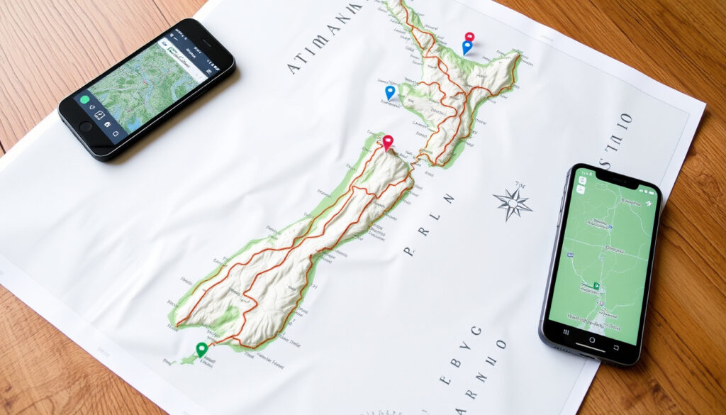
Map of the North Island: Tourist, Road & Hiking Maps (2025)
Planning a North Island trip and already feeling a bit lost before you’ve even packed a bag? That’s normal — the island packs a lot into 113,729 square kilometres, from volcanic plateaus to coastal highways, and the map you choose can make or break how smoothly your itinerary flows. Whether you’re plotting a road trip along State Highway 1, looking for a hut-to-hut hiking route, or just want a printable backup when phone signal drops, this guide walks through the strengths of each map type so you can pick the one that fits your activity.
Area: 113,729 sq km ·
Population: Approximately 3.9 million ·
Major regions: 9 ·
Highest point: Mount Ruapehu (2,797 m) ·
Major cities: Auckland, Wellington, Hamilton, Tauranga ·
State Highway 1 length: ~1,100 km
Quick snapshot
- North Island area is 113,729 sq km and population approximately 3.9 million (Tourism New Zealand official touring map)
- Official tourism map is available on newzealand.com (National Library of New Zealand catalog entry)
- LINZ produces authoritative topographic maps (Department of Conservation)
- Which map is best for hiking depends on specific trail and preferences
- Exact availability of free printable maps at visitor centers varies by location
- DOC bookings are open for stays to 30 June 2027 (Department of Conservation)
- Download the PDF touring map from Tourism New Zealand for route planning
- Check DOC Great Walks for booking availability on hikes
Six key facts, one pattern: the North Island’s geography is compressed enough that a good map becomes your trip’s backbone rather than a nice extra.
| Label | Value |
|---|---|
| Area | 113,729 sq km |
| Population | Approximately 3.9 million |
| Number of regions | 9 |
| Highest point | Mount Ruapehu (2,797 m) |
| Major cities count | 5 (Auckland, Wellington, Hamilton, Tauranga, Napier) |
| Length of State Highway 1 | ~1,100 km |
What are the best tourist maps of the North Island?
Where to find official tourist maps?
- Tourism New Zealand publishes a North Island touring map PDF that shows state highways, main roads, railway, and ferry routes (National Library of New Zealand (catalog entry for the official touring map)).
- AA Travel maps are a popular choice and widely available at petrol stations and visitor centers.
- Downloads are free via the Tourism New Zealand trade site.
What do tourist maps highlight?
- They highlight the Twin Coast Discovery Highway (6 days recommended, from Auckland to Cape Reinga) with beaches, fishing, surfing, diving, dolphin encounters, Waitangi experiences, forest hikes, and craft shopping.
- The Pacific Coast Highway links Coromandel, Bay of Plenty, Eastland, Auckland, and Hawke’s Bay.
- Tourist maps show attractions, accommodation, and highlights — ideal for trip planning.
The official Tourism New Zealand map is free, downloadable, and built for route planning — but it won’t help you navigate a trailhead. That’s where topographic maps take over.
The implication: choose the official map for route planning, but switch to a topographic map for on-the-ground navigation.
Which towns are on the North Island map?
What are the major towns and cities?
- Auckland, Wellington, Hamilton, Tauranga, Rotorua, Napier, New Plymouth are the key towns featured on all major maps.
- Smaller towns like Taupo, Whangarei, Gisborne are also included.
- The National Library of New Zealand catalog entry for the North Island touring map notes travel times and a table of distances (National Library of New Zealand (national archives)).
How are towns ordered on a road map?
- Road maps list towns with distances between them.
- State Highway 1 runs the length of the island, and other state highways connect regions.
- Online resources like drivenz.co.nz provide such maps.
The implication: if you’re driving from Auckland to Wellington, your road map’s distance table is your most accurate time predictor — Google’s estimate can be optimistic when you factor in stops.
For drivers, the printed road map’s distance table is more reliable than digital routing algorithms when signal drops. Always carry a paper backup between towns.
Apply this to your journey: when planning multi-stop drives, use the distance table to set realistic expectations rather than relying on digital ETAs.
How to use Google Maps for the North Island?
How to get driving directions?
- Google Maps provides real-time navigation and traffic updates for the North Island.
- Street View is available for many roads, helping you preview turns and parking.
Can I use Google Maps offline?
- Offline maps can be downloaded for areas with poor signal — essential for the Forgotten World Highway or remote coastal routes.
- Download the region (e.g., “North Island”) while on Wi-Fi.
The catch: offline maps don’t include real-time traffic or alternative route suggestions. For long stretches on State Highway 1, carry a paper map as a fallback.
Where can I find a road map of the North Island with towns?
What are the main highways?
- State Highway 1 runs ~1,100 km the length of the island.
- Other state highways connect regions.
- The 150 km Forgotten World Highway (State Highway 43) is described as a scenic journey through untouched landscapes.
How to estimate travel times?
- Road maps with towns include distance markers and travel times.
- The National Library catalog entry for the North Island touring map notes a table of distances (National Library of New Zealand (national archives)).
- Online resources like drivenz.co.nz provide such maps.
The trade-off: a printed road map gives you distance data but not real-time road conditions. For the Forgotten World Highway, check NZTA road alerts separately.
The Forgotten World Highway (SH43) is gravel in sections and can be impassable after rain. A printed road map won’t warn you — always check local road conditions before departure.
The pattern: for the most remote routes, combine a printed road map with a real-time road condition check to avoid surprises.
What does a detailed map of the North Island include?
What topographic details are shown?
- Detailed maps show elevation, rivers, national parks.
- They include scenic routes, camping grounds, DOC huts.
- The Department of Conservation maintains official Great Walks information and states bookings are open for stays to 30 June 2027 (Department of Conservation (New Zealand government agency)).
What scale is typical?
- LINZ (Land Information New Zealand) produces topographic maps — scale often 1:250,000 or 1:50,000.
- The Tourism New Zealand touring map has a scale of 1:1,250,000 (National Library of New Zealand).
- A Tourism New Zealand North Island walking trails PDF exists for trade use (Tourism New Zealand official walking trails map).
For hikers tackling the Tongariro Alpine Crossing, the LINZ 1:50,000 series is essential — the 1:1,250,000 touring map is too coarse for trail navigation.
“The 1:50,000 series are most detailed for tramping and are the standard for backcountry navigation.”
— Land Information New Zealand (via Department of Conservation)
“Use the official touring map for itinerary planning and visit i-SITE centers for free maps.”
— New Zealand Tourism Board (via National Library of New Zealand)
For drivers planning a Pacific Coast Highway itinerary, the choice between a 1:1,250,000 touring map and a 1:50,000 topographic map is the difference between knowing the route and finding the trailhead. The implication is clear: if you’re hiking, don’t leave home without a LINZ topographic map and a DOC-booking confirmation.
guestnewzealand.com, youtube.com, cartovia.com, runawaytraveller.com, en.wikipedia.org, kiwijournal.nz, neverendingvoyage.com, greatwalksofnewzealand.co.nz
Frequently asked questions
How to read a map scale?
A map’s scale shows the ratio of distance on the map to real-world distance. On a 1:50,000 map, 1 cm equals 500 metres on the ground. Larger denominators (e.g., 1:1,250,000) cover more area with less detail.
What is the best offline map app for the North Island?
Google Maps allows offline downloads of selected regions. For hiking, apps like Maps.me or Avenza (which uses LINZ topographic PDFs) are more reliable on the trail.
Are there maps for specific regions like Bay of Islands?
Yes. Tourism New Zealand’s regional maps and i-SITE visitor centers offer free maps for the Bay of Islands, Coromandel, and other areas. LINZ also produces regional topographic sheets.
How to get a map of the North Island in PDF?
Download the Tourism New Zealand touring map PDF directly from their trade site. LINZ topographic maps are available as PDFs through the LINZ Data Service.
What is the difference between a map and a GPS?
A paper map gives you spatial context and route overview at a glance. A GPS provides turn-by-turn navigation but can lose signal in remote areas. For the North Island, use both.
Can I get a map of the North Island at visitor centers?
i-SITE visitor centers throughout New Zealand stock free printed touring maps and brochures. Availability varies, so call ahead for specific maps.
How often are road maps updated for the North Island?
Touring maps by Tourism New Zealand are updated every few years. For real-time changes (new roundabouts, road closures), check the NZ Transport Agency website.
For drivers planning a Pacific Coast Highway itinerary, the choice between a 1:1,250,000 touring map and a 1:50,000 topographic map is the difference between knowing the route and finding the trailhead. For the North Island road-tripper, the smart move is to download the official tourism map, carry a paper backup of your key route, and, if hiking, grab a LINZ 1:50,000 sheet — or risk a wrong turn at the Forgotten World Highway.
More related posts
 NZTA Speed Cameras Range: Minimum Distances & Fines
 Bed Bath and Beyond Hornby – Opening Hours, Address and Contacts
 Auckland to Vancouver Flight Time: 13 Hours Non-Stop
 Weather in Wellington Tomorrow: Forecast & Details
 BNZ Rapid Save Interest Rate: 1.70% vs Better Alternatives
 Monkey with Big Nose – Proboscis Facts, Habitat, Survival
 Hong Kong vs Man United: Result, Highlights & Where to Watch
 Best Stourbridge Fish and Chips: Takeaways, Menus & Delivery